İçeriğe geç

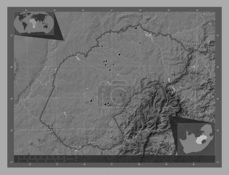
Free State, province of South Africa. Bilevel elevation map with lakes and rivers. Locations of major cities of the reg…
Önizleme filigranlıdır. Orijinal dosya lisans alındıktan sonra indirilir.

Açıklama

Free State, province of South Africa. Bilevel elevation map with lakes and rivers. Locations of major cities of the region. Corner auxiliary location maps

Benzer içerikler

Free State, province of South Africa. Bilevel elevation map with lakes and rivers. Corner auxiliary location maps
Yarr65 DP-642248188
Free State, province of South Africa. Bilevel elevation map with lakes and rivers. Locations and names of major cities …
Yarr65 DP-642248144
Limpopo, province of South Africa. Bilevel elevation map with lakes and rivers. Corner auxiliary location maps
Yarr65 DP-642250234
Limpopo, province of South Africa. Bilevel elevation map with lakes and rivers. Locations of major cities of the region…
Yarr65 DP-642250226
Free State, province of South Africa. Grayscale elevation map with lakes and rivers. Locations of major cities of the r…
Yarr65 DP-642248150
Masvingo, Zimbabwe vilayeti. Göllü ve nehirli çift katlı yükseklik haritası. Bölgenin büyük şehirlerinin yerleri. Köşed…
Yarr65 DP-651155418
Dolnoslaskie, voivodeship|province of Poland. Bilevel elevation map with lakes and rivers. Locations of major cities of…
Yarr65 DP-637594570
Masvingo, Zimbabwe vilayeti. Göllü ve nehirli çift katlı yükseklik haritası. Köşedeki yedek konum haritaları
Yarr65 DP-651155472
Free State, province of South Africa. Grayscale elevation map with lakes and rivers. Corner auxiliary location maps
Yarr65 DP-642248226
Manyara, region of Tanzania. Bilevel elevation map with lakes and rivers. Locations and names of major cities of the re…
Yarr65 DP-642481776
Mashonaland West, Zimbabwe vilayeti. Göllü ve nehirli çift katlı yükseklik haritası. Bölgenin büyük şehirlerinin yerler…
Yarr65 DP-651154878
Dolnoslaskie, voivodeship|province of Poland. Bilevel elevation map with lakes and rivers. Corner auxiliary location ma…
Yarr65 DP-637594586