İçeriğe geç

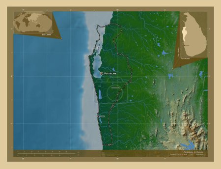
Puttalam, district of Sri Lanka. Elevation map colored in wiki style with lakes and rivers. Locations and names of majo…

Önizleme filigranlıdır. Orijinal dosya lisans alındıktan sonra indirilir.

Açıklama

Puttalam, district of Sri Lanka. Elevation map colored in wiki style with lakes and rivers. Locations and names of major cities of the region. Corner auxiliary location maps

Benzer içerikler

Puttalam, district of Sri Lanka. Elevation map colored in wiki style with lakes and rivers. Locations of major cities o…
Yarr65 DP-642335424
Puttalam, district of Sri Lanka. Elevation map colored in wiki style with lakes and rivers. Corner auxiliary location m…
Yarr65 DP-642335458
Puttalam, district of Sri Lanka. Colored elevation map with lakes and rivers. Corner auxiliary location maps
Yarr65 DP-642335400
Puttalam, district of Sri Lanka. Colored elevation map with lakes and rivers. Locations and names of major cities of th…
Yarr65 DP-642335358
Puttalam, district of Sri Lanka. Colored elevation map with lakes and rivers. Locations of major cities of the region. …
Yarr65 DP-642335356
Biyoloji, Şili bölgesi. Yükseklik haritası göller ve nehirlerle wiki tarzında renklendirilmiş. Köşedeki yedek konum har…
Yarr65 DP-610627112
Namibe, Angola vilayeti. Gölleri ve nehirleri olan renkli yükseklik haritası. Köşedeki yedek konum haritaları
Yarr65 DP-606603316
Namibe, Angola vilayeti. Gölleri ve nehirleri olan renkli yükseklik haritası. Bölgenin büyük şehirlerinin yerleri. Köşe…
Yarr65 DP-606603302
Tartus, province of Syria. Elevation map colored in wiki style with lakes and rivers. Locations of major cities of the …
Yarr65 DP-642371744
Benguela, Angola vilayeti. Yükseklik haritası sepya tonlarında göller ve nehirlerle renklendirilmiş. Bölgenin büyük şeh…
Yarr65 DP-606600638
Tartus, province of Syria. Elevation map colored in wiki style with lakes and rivers. Corner auxiliary location maps
Yarr65 DP-642371732
Valparaiso, Şili bölgesi. Yükseklik haritası göller ve nehirlerle wiki tarzında renklendirilmiş. Köşedeki yedek konum h…
Yarr65 DP-610644912