İçeriğe geç

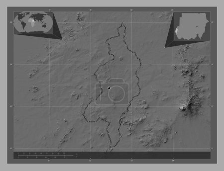
Blue Nile, state of Sudan. Bilevel elevation map with lakes and rivers. Corner auxiliary location maps

Önizleme filigranlıdır. Orijinal dosya lisans alındıktan sonra indirilir.

Açıklama

Blue Nile, state of Sudan. Bilevel elevation map with lakes and rivers. Corner auxiliary location maps

Benzer içerikler

Blue Nile, state of Sudan. Bilevel elevation map with lakes and rivers. Locations of major cities of the region. Corner…
Yarr65 DP-642337960
Blue Nile, state of Sudan. Grayscale elevation map with lakes and rivers. Corner auxiliary location maps
Yarr65 DP-642338036
Blue Nile, state of Sudan. Bilevel elevation map with lakes and rivers. Locations and names of major cities of the regi…
Yarr65 DP-642337982
Blue Nile, state of Sudan. Grayscale elevation map with lakes and rivers. Locations of major cities of the region. Corn…
Yarr65 DP-642337988
Plato, Nijerya eyaleti. Göllü ve nehirli çift katlı yükseklik haritası. Bölgenin büyük şehirlerinin yerleri ve isimleri…
Yarr65 DP-618909992
Central Darfur, state of Sudan. Bilevel elevation map with lakes and rivers. Corner auxiliary location maps
Yarr65 DP-642338290
Central Darfur, state of Sudan. Bilevel elevation map with lakes and rivers. Locations of major cities of the region. C…
Yarr65 DP-642338254
Kumamoto, Japonya ili. Göllü ve nehirli çift katlı yükseklik haritası. Bölgenin büyük şehirlerinin yerleri. Köşedeki ye…
Yarr65 DP-614890554
Kars, province of Turkiye. Bilevel elevation map with lakes and rivers. Locations and names of major cities of the regi…
Yarr65 DP-642569510
Kumamoto, Japonya ili. Göllü ve nehirli çift katlı yükseklik haritası. Köşedeki yedek konum haritaları
Yarr65 DP-614890578
Plato, Nijerya eyaleti. Göllü ve nehirli çift katlı yükseklik haritası. Bölgenin büyük şehirlerinin yerleri. Köşedeki y…
Yarr65 DP-618909968
West Darfur, state of Sudan. Bilevel elevation map with lakes and rivers. Corner auxiliary location maps
Yarr65 DP-642341466