İçeriğe geç

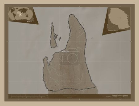
Zanzibar North, region of Tanzania. Bilevel elevation map with lakes and rivers. Corner auxiliary location maps

Önizleme filigranlıdır. Orijinal dosya lisans alındıktan sonra indirilir.

Açıklama

Zanzibar North, region of Tanzania. Bilevel elevation map with lakes and rivers. Corner auxiliary location maps

Benzer içerikler

Zanzibar North, region of Tanzania. Bilevel elevation map with lakes and rivers. Locations of major cities of the regio…
Yarr65 DP-642488952
Zanzibar North, region of Tanzania. Grayscale elevation map with lakes and rivers. Locations and names of major cities …
Yarr65 DP-642489008
Zanzibar North, region of Tanzania. Grayscale elevation map with lakes and rivers. Corner auxiliary location maps
Yarr65 DP-642489042
Zanzibar North, region of Tanzania. Grayscale elevation map with lakes and rivers. Locations of major cities of the reg…
Yarr65 DP-642488974
Madinat ash Shamal, municipality of Qatar. Bilevel elevation map with lakes and rivers. Corner auxiliary location maps
Yarr65 DP-637606678
Zanzibar North, region of Tanzania. Elevation map colored in sepia tones with lakes and rivers. Locations and names of …
Yarr65 DP-642489184
Libya 'nın Nuqat al Khams semti. Gölleri ve nehirleri olan gri tonlama yükseklik haritası. Köşedeki yedek konum harital…
Yarr65 DP-616366110
Al Daayen, municipality of Qatar. Grayscale elevation map with lakes and rivers. Corner auxiliary location maps
Yarr65 DP-637605872
Libya 'nın Nuqat al Khams semti. Gölleri ve nehirleri olan gri tonlama yükseklik haritası. Bölgenin büyük şehirlerinin …
Yarr65 DP-616366100
Zanzibar North, region of Tanzania. Bilevel elevation map with lakes and rivers. Locations and names of major cities of…
Yarr65 DP-642488962
Gabes, governorate of Tunisia. Grayscale elevation map with lakes and rivers. Corner auxiliary location maps
Yarr65 DP-642583608
Gabes, governorate of Tunisia. Grayscale elevation map with lakes and rivers. Corner auxiliary location maps
Yarr65 DP-642496724